Day 85: Nongchan – Boualapha (185m) 41km. Mostly flat/gently rolling dirt.
Day 86: Boualapha – Villabury (230m) 66km. Rolling dirt road.
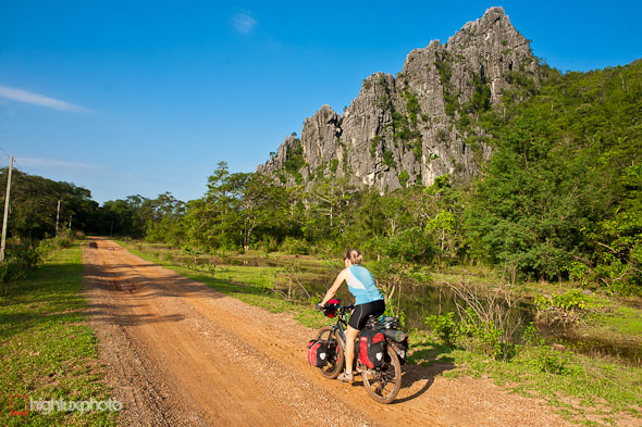 Ever since arriving in Laos we’d had it in mind to try and seek out and ride some of the legendary Ho Chi Minh Trail – figuring it would offer some good off-highway riding, get to some remote villages, and be a compelling journey through history.
Regarded by historians as one of the greatest wartime engineering feats in history, the Ho Chi Minh Trail (North Vietnam’s name for it was the Truong Son Strategic Supply Route) was the key supply line for troops and supplies fueling the North Vietnamese war effort during the Vietnam War (aka the American War).
The trail – actually a constantly changing network of tracks and roads – forged south from Hanoi, into Laos and Cambodia and at certain points made incursions into South Vietnam. A substantial part of the USA and South Vietnam’s war effort was devoted to destroying the trail, stopping troop and supply movements and to monitoring movements in the regions the trail passed though. High explosive, anti personnel cluster bombs, mines, defoliants and napalm were all used along the trail, as well as the less conventional tactics of dropping soil destabilisers (to cause slips), soap and even beer (to cause drunkeness!) on the route! Seismic activity sensors (disguised as shrubs) were dropped to detect vehicle movement.
Laos was supposedly neutral during the Vietnam conflict but in actuality was one of the major battle areas of the war. Both sides tried to keep the war in Laos a secret. The North Vietnamese denied that they were using Laos to infiltrate South Vietnam and the US government did not want to acknowledge publicly that the war had expanded beyond Vietnam.
The route we were intending to take traversed a section of the trail for 220km from Nongchan, in the north, down to Sepon on highway 9 in the south, with approximately half of it dirt/4WD road.
After a day off (mostly spent servicing the bikes) in Nongchan we set off early, not really having much idea if the route would be passable or not – given that it was the wet season and and the fact that our map (supposedly the best available!) had already proved several times to be inaccurate. We figured that if things didn’t go to plan we’d ride back out and catch a bus back west!
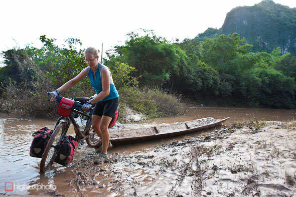
The road turned to smooth surfaced dirt right out of Nongchan, and after only a few kilometres we came to the first ‘challenge’. Wet season rains had left all watercourses swollen (though they’d dropped a lot from a few days previous by the looks), and the only way across this one was via a convenient roll-on, roll off ferry. This boat is specially designed for motorcycles (by far the most common form of transport here), and is operated by a ferryman who hangs out by the river all day, shuttling people – albeit not very many – back and forth.
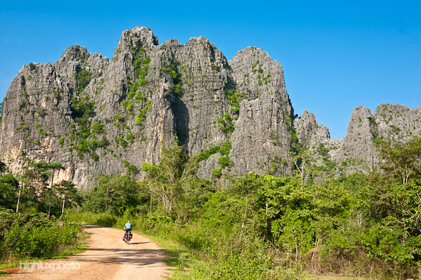
Pretty much dead flat, the road wound its way through awesome karst formations, rice paddies and wetlands. Auspiciously, it was also the day of my 40th birthday – what a sweet way to spend it!
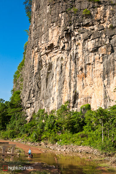
Towering cliffs, abundant crags, and just the odd wade through sections of flooded road.
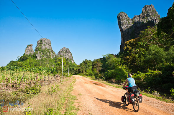
The further we rode, more amazing landscape unfolded. The ‘Leaning Tower’ formation on the right was a good 150 – 200 metres high.
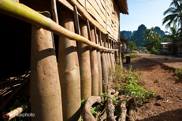
Cluster bomb cannisters in a village about 20km into the ride. These ones are shoring up a wall, but they are often used as piles for stilt houses too. After these cannisters are dropped from aircraft and they split in two and release hundreds of tennis-ball-sized ‘bomblets’ over a wide area, each with a blast radius of 30m. An insidious weapon in the same category as landmines, they’re designed as an anti personnel and terror device. Millions of them still lie in Laos farmland and jungles, waiting to explode after a farmer accidently strikes one or a child picks one up out of curiosity.
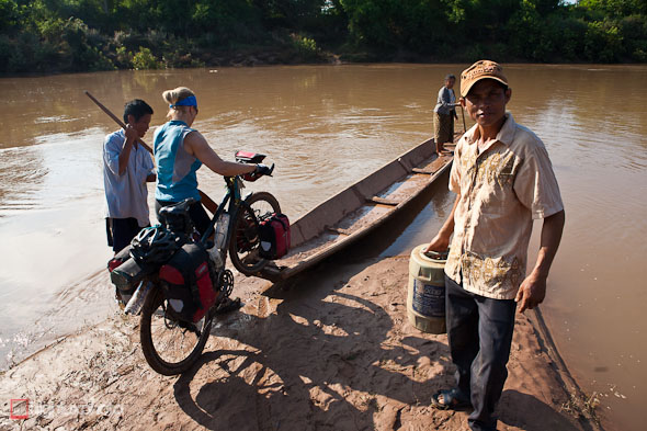
Roll-on roll-off ferry number two. The key to these is to stay astride your bike once aboard – and avoid any sudden shifts of weight!
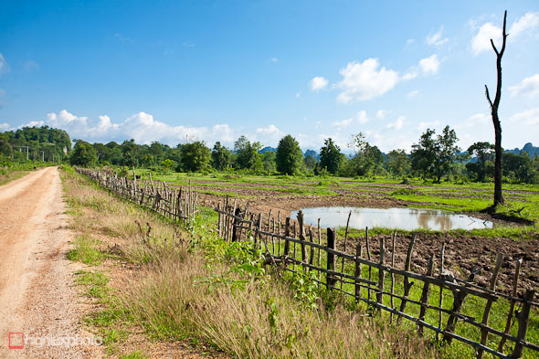
In a scene reminiscent of the Somme, water filled bomb craters flanked the road at regular intervals.
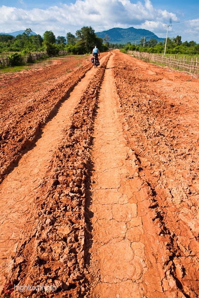
We’re thankful that three days of fine weather have dried out most of the road surface. Would have been very hard going otherwise.
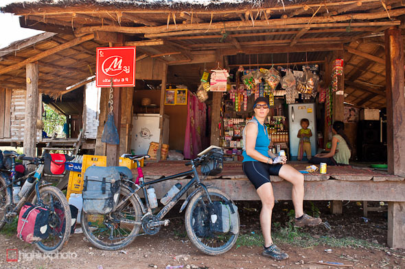
We do our bit for the local economy by stopping to buy drinks and snacks. It’s the wet season and for months this village is inaccessible by anything other than motorbikes.
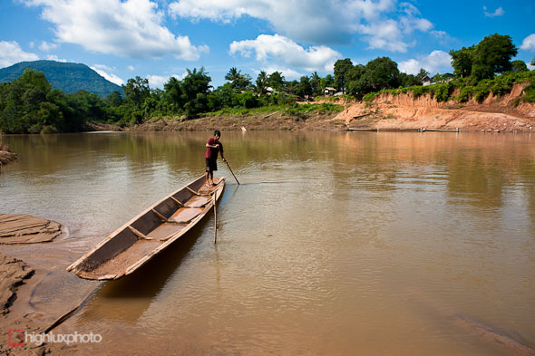
River cossing number three – all within the first 25km on the road.

One type of cluster bomb was deployed from large aluminium tubes (out of a parent container). These are omnipresent in Laos’ central provinces and have been extensively recycled into cowbells. Left intact, the tubes are often seen as the two uprights on homemade ladders that people use to access their stilt houses.

This cup has been made from a section of aluminium tube that once deployed cluster bombs. The date on the side is 3.68.
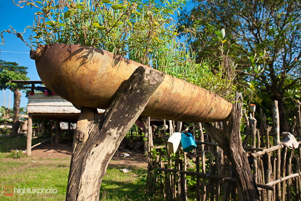
Cluster bomb cannister recycled and used as a planter. A very common sight in the smaller villages here.
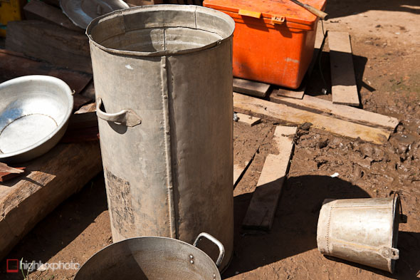
Rice or water storage container and bucket; both recycled from aircraft scrap.
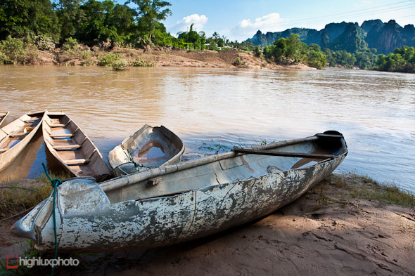
More recycled war scrap: this one a canoe made from a fighter bomber’s jettisoned long range fuel cannister. We figured this area might have a few signs of the maelstrom of bombing that it suffered, but it’s pretty much impossible to escape the war’s legacy here.
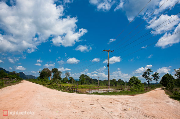
Junction. We came in from viewers right. The road on the left was marked on our map as nothing more than a 4WD track. Turns out there was occasional traffic on it and it was in better condition than ours, which was marked as a secondary road. I think it would be possible to ride the LH road all the way from (or to) highway 12.
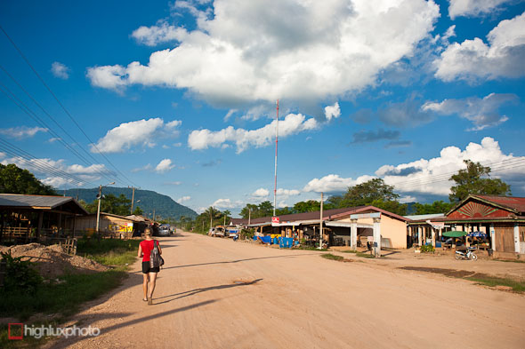
We ended the day in Boualapha after 44km. Boualapha was one of those anomalies you come across on the road now and then: it wasn’t on our map, yet it was the district capital and the only place with a guesthouse for another 70km. Being my birthday and all – and the fact that it was searingly hot by midday, we decided to chill out for the day.
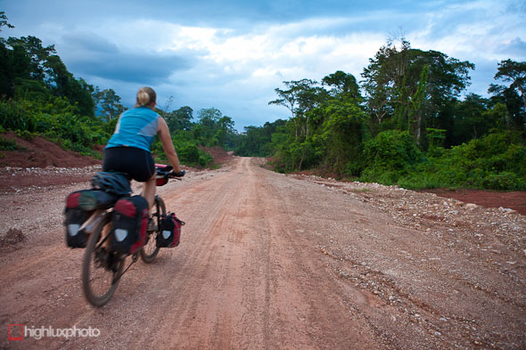
Next morning we were up at 4am and riding by 5am to beat the heat. That’s more or less been our modus operandi lately and means we’ve usually racked up our day’s miles by midday. That leaves the afternoon for a nap and reading/computer time.
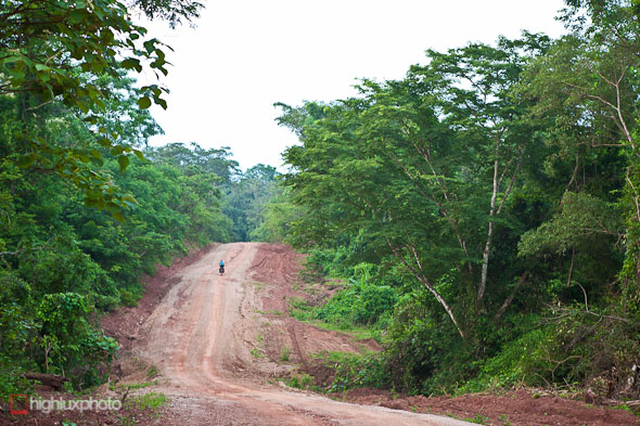
Sadly the jungle here’s nothing like it was pre-war. The mighty canopies have mostly been shattered by bombing, poisoned, or burnt. But it’s getting lush again after nearly 40 years of re-gen.
To quote from US Air Force historian Eduard Mark (more here) “After years of heavy bombing, the landscape of the passes, stripped of vegetation and pockmarked by craters, was lunar … this probably made it easier for the North Vietnamese to keep the passes open. ??The pattern of the bombs dropped by a cell of B-52s was so adjusted that they were distributed evenly through a box. Relatively few bombs would, on average, strike the narrow roads. Where they did, temporary bypasses could be readily constructed in treeless areas where the soil, tilled by thousands of bombs, had become easier to work. Craters in the road could be filled with the spoil from adjacent craters.”
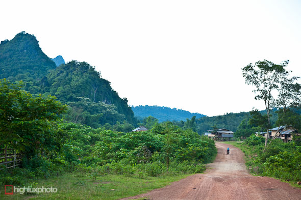
Sweet touring: no cars, a skinny dirt road through endless jungle and limestone peaks, and minority villages here and there.
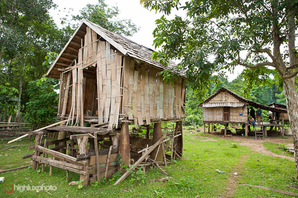
We wandered around one small village that had clearly seen the full attention of the US during the war. Many houses, like this one, were on cluster bomb case stilts.
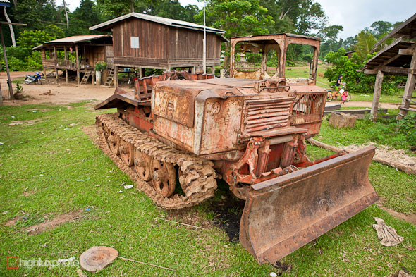
An ancient bulldozer, of Chinese or Russian origin probably, also sat in the village. It looked like it had some stories to tell, and I guess it was probably used by the North Vietnamese to construct and maintain the trail. Amazingly, it was still serviceable and being used!
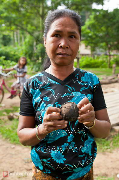
This lady showed us a cluster bomb (opened and defused) that had been found in the village. The USA dropped 270 million of this type of bomb on Laos between 1964-1973. The fins on the bomblet (Laotians call them bombies) make it spin in the air, which arms the fuse. They can be fused to explode on impact, 9m above the ground, or randomly. Roughly a third of them did not explode at all, and it’s these that plague Laos to this day; approximately 25% of villages in Laos are still contaminated with unexploded ordinance.
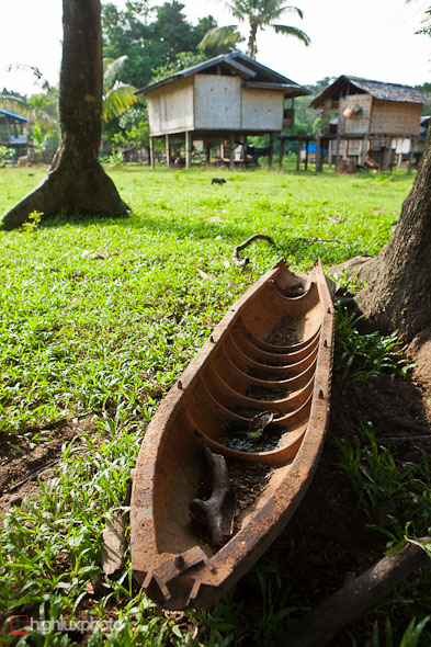
A discarded cluster bomb case.
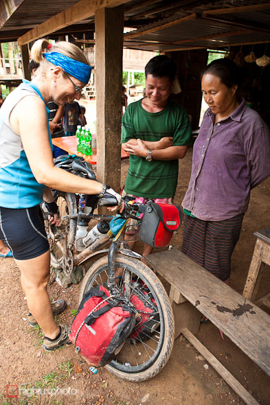
Hana shows our speedometer to a couple of villagers.

Some of the locals weren’t so friendly.
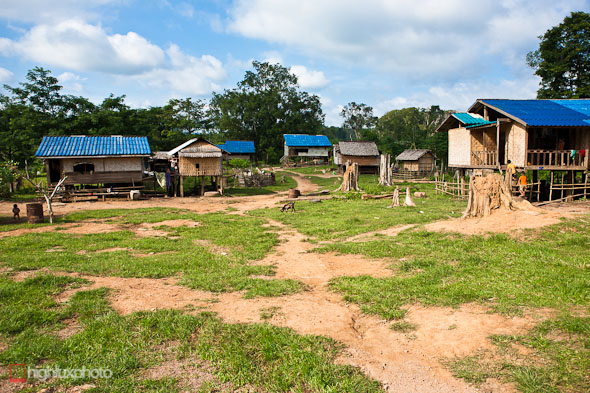
Blue roofed huts dominated one village – possibly Hmong?
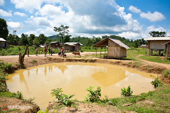
Some of the villages we passed through had more cratered land than flat, unbombed, land. This one was huge!
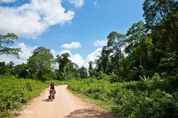
More quality road… We ended the second day in Villabury, from where the road would be sealed again (though still the Ho Chi Minh Tail) through to the larger town of Sepon on highway 9.



Amazing post Watson! Thank You! Roll on my brother, happy birthday.
cheers mate! Happy birthday to you too! x
I’m really enjoying following your and Hana’s journey Mark. Happy birthday!
Cheers – looking forward to getting back to shaky Chch scene sometime too!