Day 194: Banda Aceh to Lamno, 84km. Good coastal road over several headlands. 630m climbing.
Day 195: Lamno to Calang, 75km. Mostly flat coastal road. 250m climbing.
Day 196: Calang to Meulaboh, 105km. Flat road through coastal plains and wetlands.
Day 197-198: Mark sick in Meulaboh.
After two days in Banda Aceh we were itching to discover what lay south and the next morning set off on our 2500km journey down the giant island of Sumatra. We planned to head south along the West Coast for three days to Meulaboh and then head east inland and into the highlands. A brand new USAID-built road led the way and the riding was excellent, with the Indian Ocean crashing ashore to meet steep jungle clad mountains and wetlands abundant with birdlife.
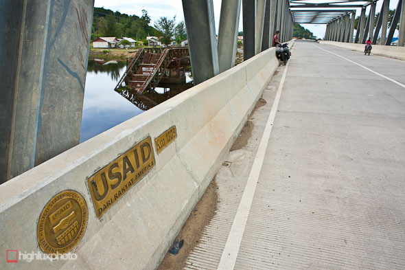
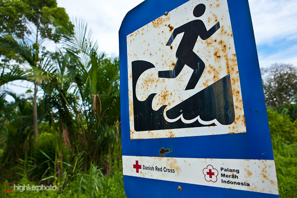
Large sections of the West Coast highway and dozens of bridges were destroyed by the 2004 tsunami. The road and bridges have been rebuilt most of the way to Meulaboh now by the USAID program and the result is an 11 metre wide highway with ultra sturdy bridges. There’s hardly any traffic on it and it’s sheer pleasure to ride for the cruise south.
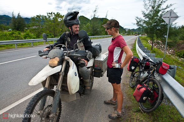
Not far out of Banda Aceh we met this German man on a 18-month motorcycle journey around the world. He was the first foreign tourist we’d seen since getting off the plane in Banda Aceh and the last we’d see for 10 days.
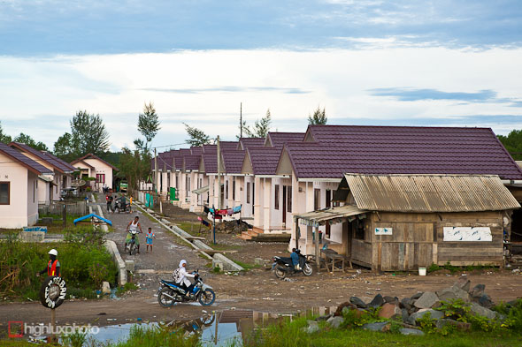
A typical sight from the new USAID highway. Virtually all of the villages along this coast were totally destroyed and new communities of identical NGO-built housing are popping up.
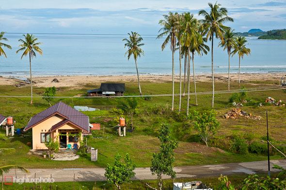
While some are not afraid to rebuild right by the sea, most of the new villages are situated to mitigate tsunami damage by being built behind hills or on higher ground.
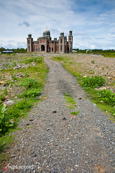
Mosques under construction were a frequent sight.
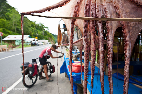
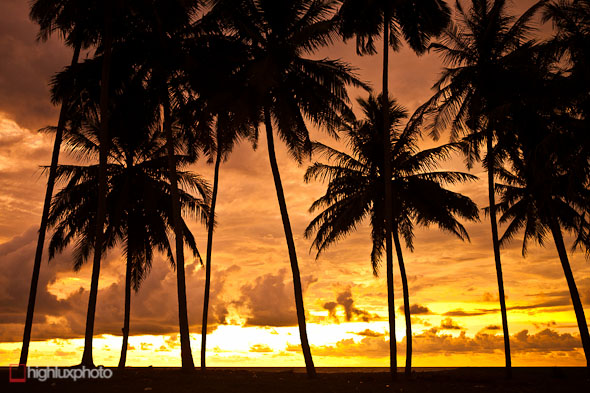
Nature provides here; with thick jungle on one side of the road and the Indian Ocean on the other.
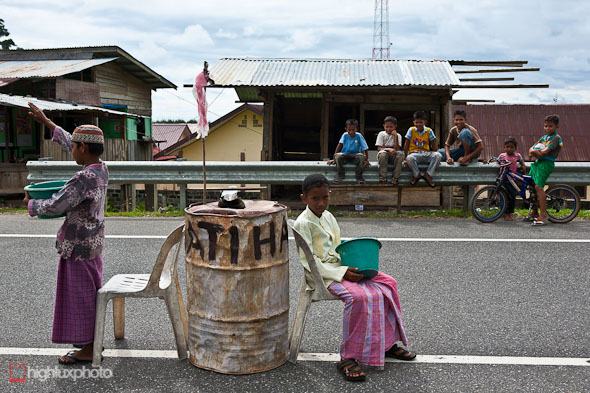
These boys were appealing to traffic to stop and give them money towards mosque rebuilding.
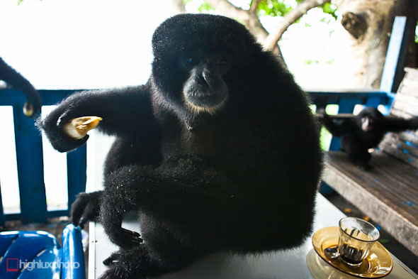
En route to Lamno we rode over some lush jungle headlands and stopped at a roadside shack for a break. Who should drop in but some gibbons and macaques. The gibbons were a family of four: dad, mum, and two children. They casually hung out eating bananas and fighting with the macacques if they got too close.
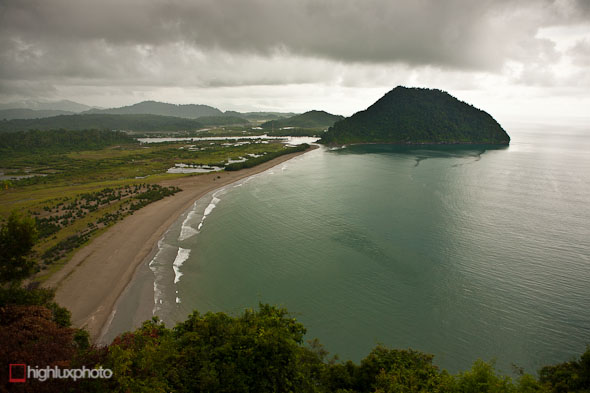
The view south from the last headland before the village of Lamno, where we stopped for the night.
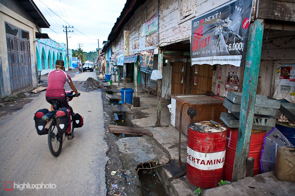
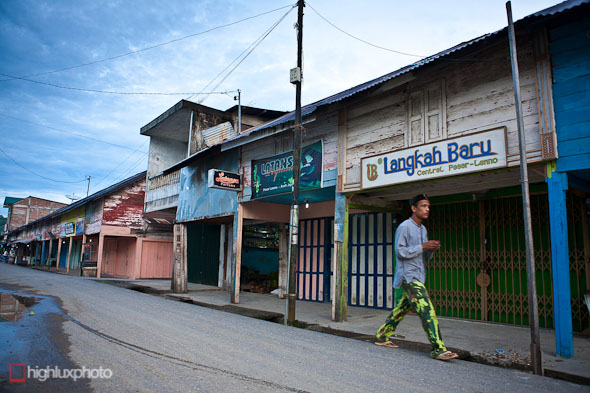
Protected by hills, Lamno was flooded but was spared total destruction in the tsunami. Consequently most of the original buildings are still standing lending the town an historic feel. Flimsy wooden shop houses, some on the verge of collapse, typify the town and entering the narrow streets you feel as if you’ve stepped back in time.
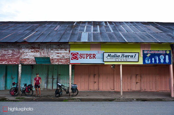
Early morning and the streets are still quiet and the shops closed in Lamno.
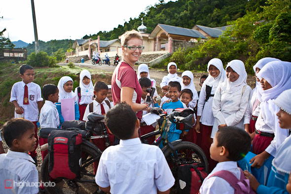
Everytime we stop we’re surrounded by curious schoolkids. Hana’s practising some Bahasa Indonesia while the kids practice their English, which is taught in most schools here but rarely spoken by adults.
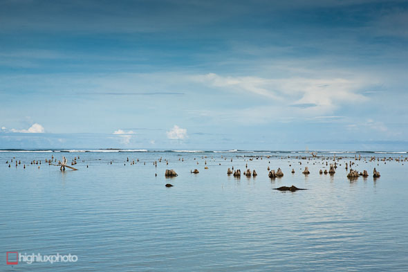
The tsunami reshaped much of the foreshore, flooding some of the coastal plain and snapping coconut palms.
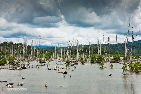
This forest of ghostly tree trunks was inundated with sea water.
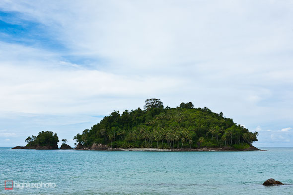
Tempting looking islands lay not far off shore.
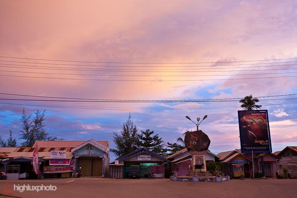
The town of Calang, on a small, low lying isthmus, was totally destroyed by the tsunami and the population halved. A calamity that is hard imagine now as you wander the dusty sreets amid hastily constructed shops and houses. Our hotel (the only one in town) had an aerial photograph on the wall of the isthmus post-tsunami and almost the entire town is gone, with only concrete foundations remaining.
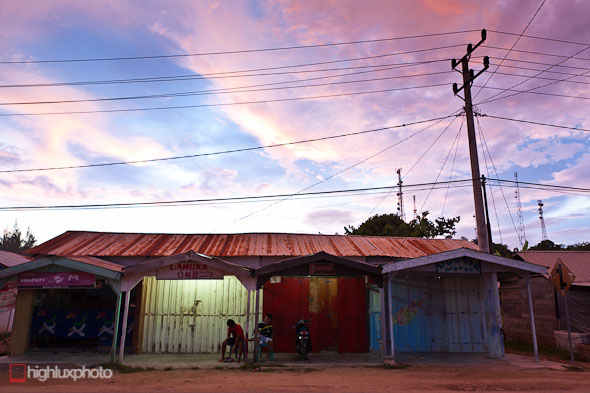
The town is slowly bouncing back though and the inhabitants, whose lives have been unimaginably fractured, were super friendly.
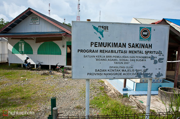
No doubt this rehab clinic is quite busy with patients.
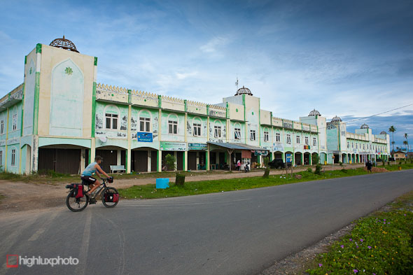
This shop house complex was built in the last seven years, but already had an ancient look about it with rusty doors and peeling paintwork.
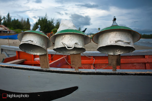
Improvised night fishing lights on the side of a boat.
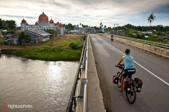
A rebuilt village on the road south to Meulaboh.
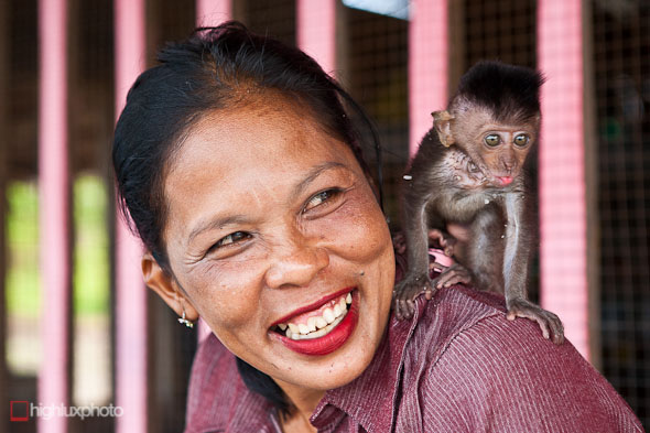
The owner of the cafe we stopped at for morning tea sported a pet monkey.
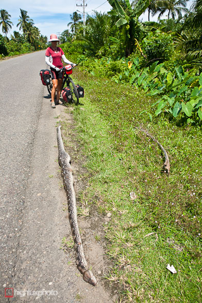
We were amazed at the size of this dead python on the side of the road. Three bulges indicated its final meals; cats, or chickens maybe?
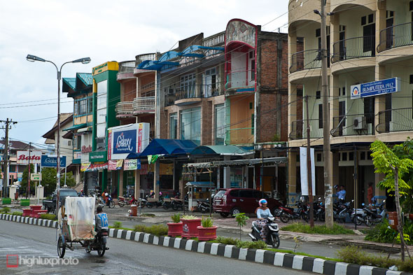
Meulaboh, 240km south of Banda Aceh, was the city closest to the epicentre of the earthquake and was often referred to by the media as ground zero. The town was largely destroyed and nearly a third of the 120,000 poulation killed. Many of the bigger concrete buildings in the city survived intact but thousands of dwellings closer to the shore were wiped out with no trace remaining. The city seemed pretty lively to us and there were a lot of new buildings in place with many more still under construction.
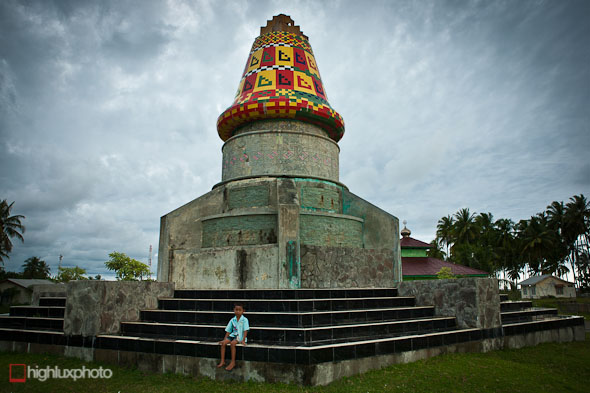
Memorial for Teuku Umar, the Acehnese hero who refused to surrender to the Dutch occupation. After a long manhunt he was killed on the beach in Meulaboh. His wife Cut Nyak Dhien continued with the resistance and has since than become a national hero. [Thanks to Lisa at Aceh Adventure for the correction].
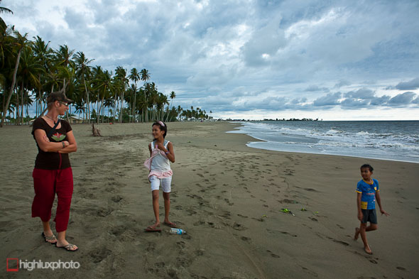
Kids practising their English with Hana on Meulaboh’s beach. We were planning to leave after only one night there but I came down with a full on temperature and bad diarrhoea during the night. I got a bit concerned when 12 hours later it turned bloody, so we made a visit to the hospital for a diagnosis and a handful of drugs. Thankfully the symptoms subsided within a few hours of taking ciprofloxacin and we made plans to leave the next day for a 45km transition day to take us closer to the highlands.



Hi awesome photos again , its so amazing that so much was lost and yet life goes on. Sx
Wow what a great pictures! Really really nice! If I’m not mistaken the statue of the hat on the beach in Meulaboh is a memorial for Teuku Umar, the Acehnese hero that refused to surrender to the Dutch occupation. After a long manhunt he was finally (?) killed on the beach in Meulaboh. His wife Cut Nyak Dhien continued with the resistance and has since than become a national hero.
I hope the climb to Takengon went well. Can’t wait to read the report. Good luck! Lisa (Aceh Adventure)
Thank you ; ) post corrected…. update coming soon!
What gorgeous photos. Amazing to see that bridge. When I travelled from Banda Aceh to Meulaboh in 1992, our bus had to drive onto a raft two separate times, to cross two rivers. At one river, the bus was pulled across by hand (there was a rope spanning the river). I chose to get off the bus & stand on the raft in case the whole thing topped into the river. At the other, the raft had a sort of outboard motor attached. On the return trip the bus lurched sideways driving off the raft at one of these rivers & got stuck, & we hung around for 3 or 4 hours while people tried to get it back onto the road. ….Sounds like it’s time for a trip back to Aceh. Amazingly, my friends from Meulaboh all survived the tsunami. Thanks for the wonderful photos.
Thanks for the comments. I knew there were no bridges post Tsunami, but even in 82! Far out. Still very basic in a lot of places in the highlands here too though. Love touring here!
oops, sorry: I meant 1982, not 1992. Can that much time really have passed?! I did visit Banda Aceh again in 1991 but didn’t travel to Meulaboh that time.
Thank you so much with all my heart to taking me back to Meulaboh where I volunteered with the South African Medical team as a psycho-social facilitator offering local teachers skills to heal themselves and to share these resources with their pupils at newly combined schools. Met so many kind, welcoming , immensely gracious and courageous people. Thank you to the leader of this city for our participation in development activities, with UNICEF funding. SO many South Africans supported our mission there. These images allowed a sense of connection – follow-up on what has happened sense. Scanned your photos for rebuilding, familiar faces and hope!
Glad you enjoyed them. Thanks for the message. We loved travelling there.
brilliant photos with great detail. I am so glad i have come across your blog as i will be visiting meulaboh later in the year. great blog!!!